AIT — territorial intelligence
Inform your population and enhance your territory: publish your geoinformation, your useful links and your official alerts directly to your residents and owners. Also monitor your territory with zones at municipality scale, and receive the official building applications that affect them. Self-service, Swiss, with no new application to deploy.
Access AIT
Your municipality's territorial intelligence.
AIT runs on desktop, via QR scan from the bat-id app.
Application overview
The modules
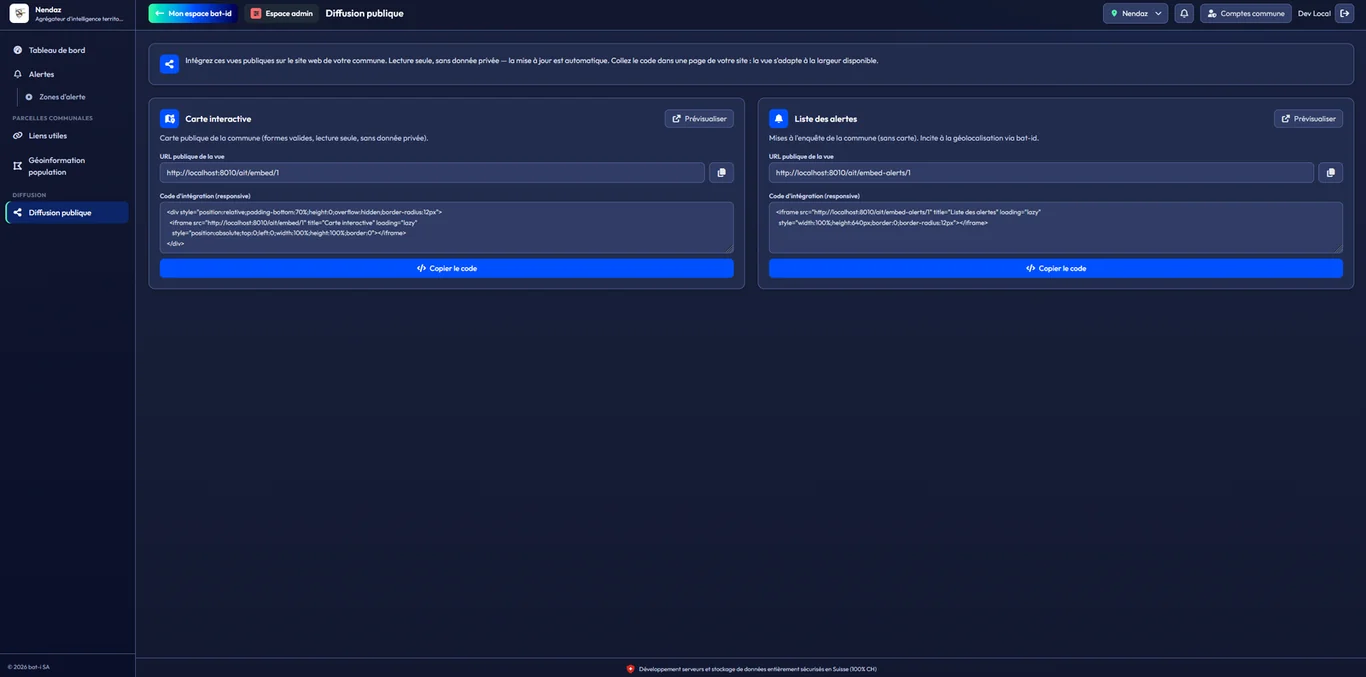
-
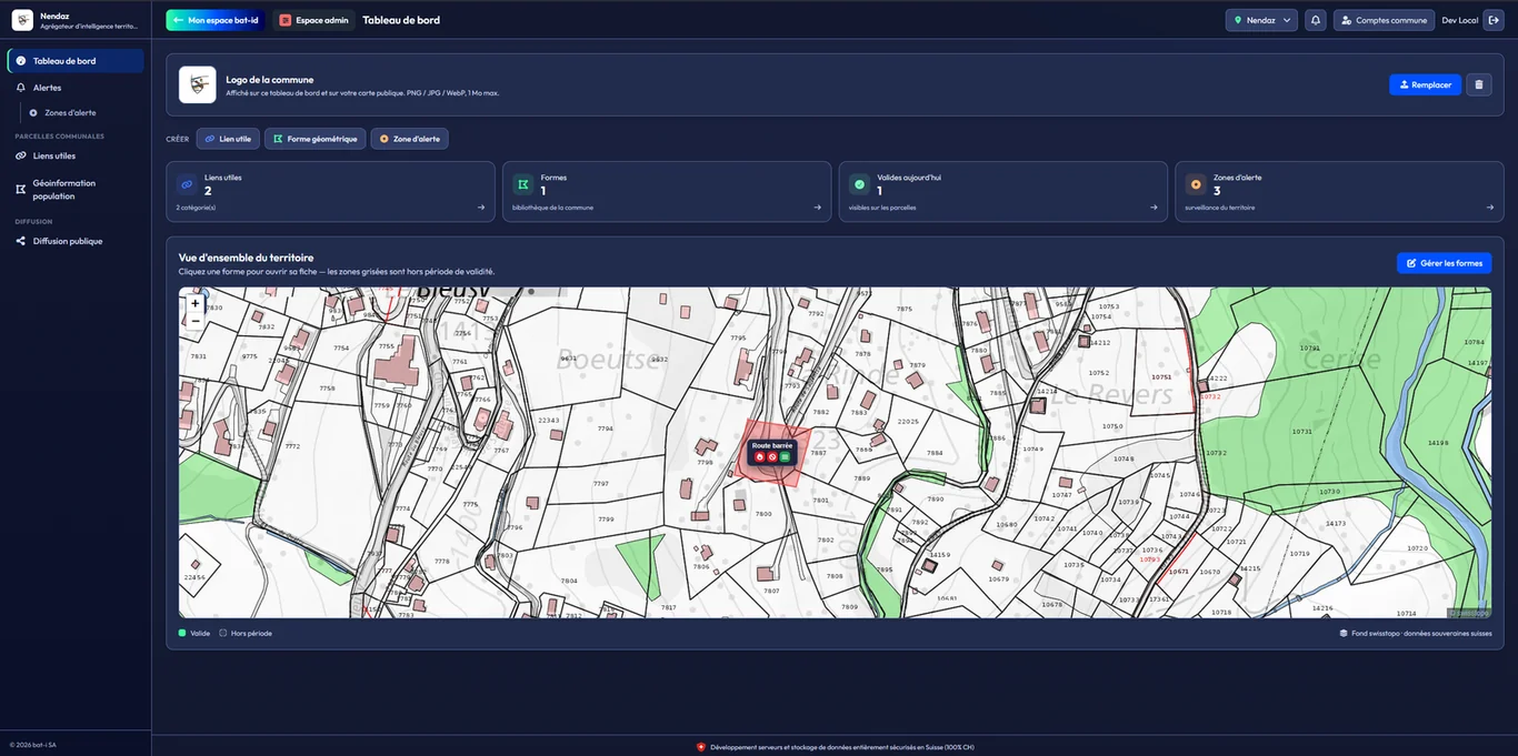
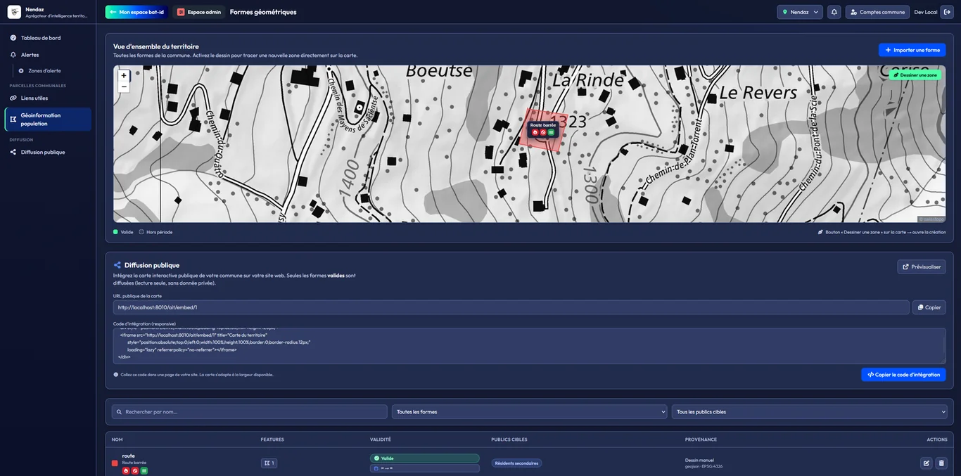
Module 01 · Territorial geoinformation
Produce your geographic shapes and project them to your population, both on your citizens' map and as an embed on the municipal website.
-
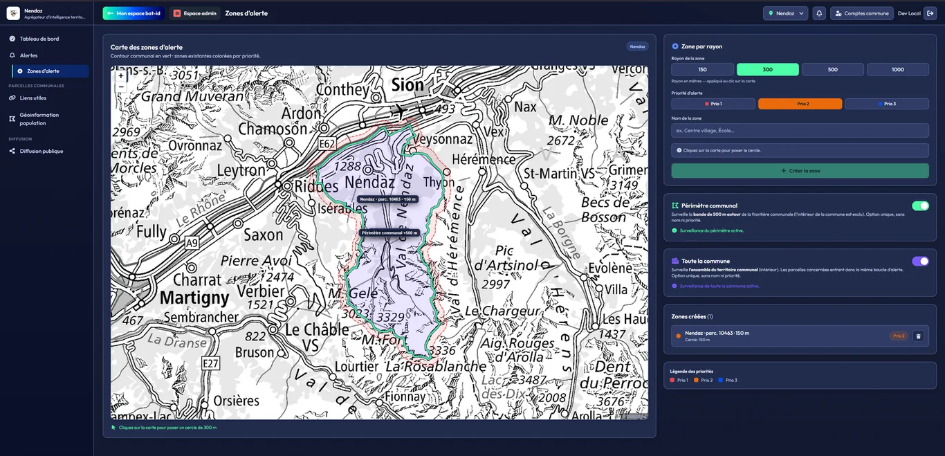
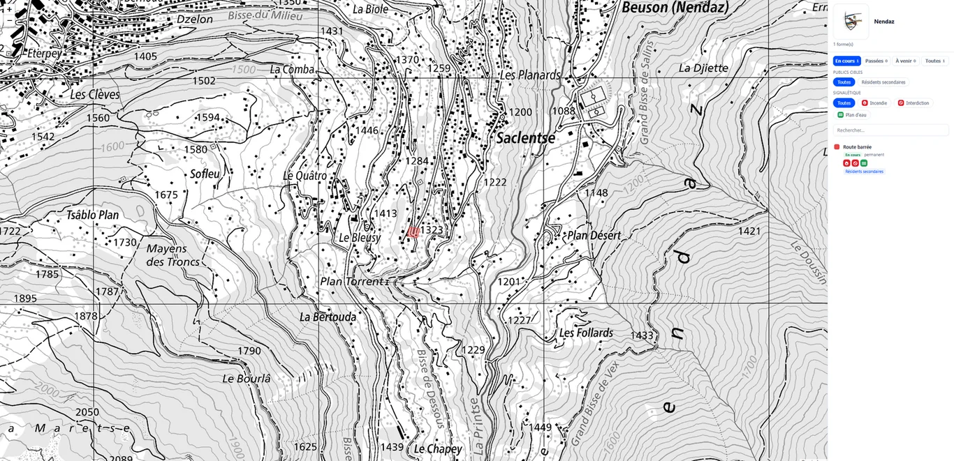
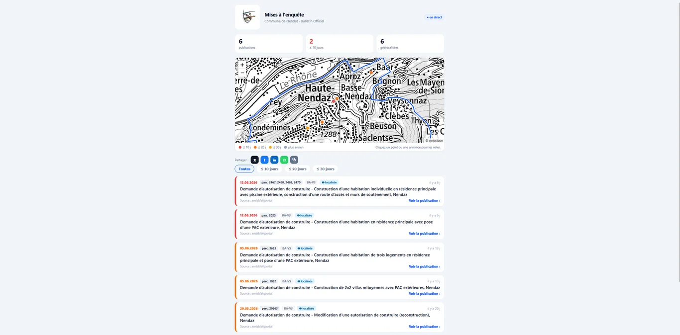
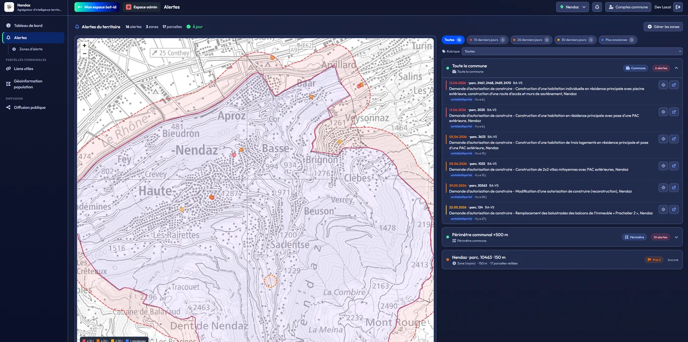
Module 02 · Territorial monitoring & alerts
Monitor your territory with zones at municipality scale and receive the official building applications that affect them.
-
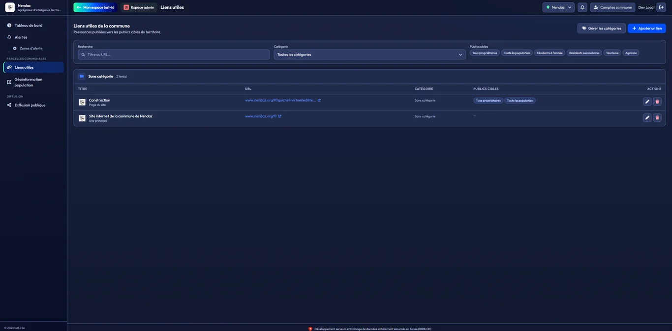
Module 05 · Useful links
Curate the municipality's public resources for the benefit of the bat-id holders in your territory, directly on their parcels.
-
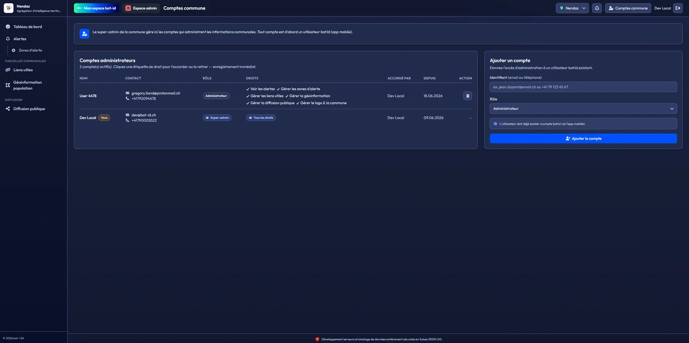
Module 07 · Municipal workspaces
Create teams for your departments — police, security, public works — with roles and rights, on each agent's bat-id identity.
Service screens
Alongside the modules, screens for consultation and configuration:
- Dashboard — the state of your municipality at a glance and the gateway to informing the population
- Logo & identity — your municipal logo on the dashboard and the public map
- Administrators — affiliate your agents and set their rights on a case-by-case basis
For whom
Municipalities, cantons and administrations that want to inform their population and enhance their territory without a heavy IT project. Technical, police and security departments administer their own instance, independently, with each agent's bat-id identity.